Alerte hauteur au dessus du terrain par un GPS IFR?
-
Hélicopter
- Participant régulier

- Posts: 594
- Joined: Thu 09 Jan, 2014 16:20
- Possédez-vous une licence de pilote?: Non spécifié
- Marque de l'avion:
- Modèle de l'avion:
- Identification de l'avion:
Alerte hauteur au dessus du terrain par un GPS IFR?
!
Last edited by Hélicopter on Wed 05 Apr, 2017 14:10, edited 1 time in total.
-
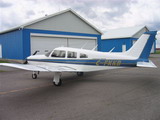
Frank KKB
- Vrai participant

- Posts: 1493
- Joined: Mon 23 Mar, 2009 07:45
- Possédez-vous une licence de pilote?: Oui
- Marque de l'avion: Piper
- Modèle de l'avion: Arrow II
- Identification de l'avion: FKKB
- Location: St-Bruno
Re: Alerte hauteur au dessus du terrain par un GPS IFR?
J'ai un 430 dans KKB et jamais personne dans ma formation IFR ne m'a dit ou expliqué que le 430 avait un genre d'avertisseur d'altitude...ce qui nous a toujours été enseigné comme tout le monde le sait, est que c'est au pilote de conserver son altitude en ayant bien sûr toujours le bon calage altimétrique lorsque l'information est disponible...
Ceci ne veut pas dire qu'il n'est pas possible de configurer le 430 d'une façon quelconque, mais si c'est le cas, je ne connais pas cette application...
François
Ceci ne veut pas dire qu'il n'est pas possible de configurer le 430 d'une façon quelconque, mais si c'est le cas, je ne connais pas cette application...
François
-
drapo

- Participant accro

- Posts: 1999
- Joined: Fri 26 Mar, 2004 15:33
- Possédez-vous une licence de pilote?: Oui
- Marque de l'avion: T-Craft
- Modèle de l'avion: Construction Amateur
- Identification de l'avion: C-FTOB
- Location: St-Eustache
Re: Alerte hauteur au dessus du terrain par un GPS IFR?
Sur mon Avidyne IFD 540, une gentille voix m'avertit lorsque je suis à 500'AGL. De plus, sur la carte GPS, il est indiqué en jaune le terrain ou obstacle à 1000' de mon altitude et en rouge ce qui est à 100'. Finalement, une boîte d'alerte indique qu'il y a obstruction si on se dirige vers un obstacle à 100' de notre altitude (3nm je crois) et un autre qui indique "Terrain Pull-up" à 1 nm ou moins.
-
jcdostie
- Top participant

- Posts: 3979
- Joined: Fri 25 Sep, 2009 08:42
- Possédez-vous une licence de pilote?: Non spécifié
- Marque de l'avion:
- Modèle de l'avion:
- Identification de l'avion:
- Location: St-Philippe
- Contact:
Re: Alerte hauteur au dessus du terrain par un GPS IFR?
Sur la page terrain du 430, le terrain est affiché avec différentes couleurs en fonction de ton altitude pour te prévenir de la séparation avec les obstacles. Ben pratique sur flottes (pas besoin d'être ifr  )
)
Y'a maintenant une nouvelle (2014) fonction qui peut être ajoutée à mise à jour
Garmin® Announces HTAWS Certification for the GNS 430W/530W
Mettons qu'à ce prix, j'vais garder mes lunettes jaune
Garmin International Inc., a unit of Garmin Ltd. (NASDAQ: GRMN), the global leader in satellite navigation, today announced it has received the FAA’s Supplemental Type Certificate (STC) for Helicopter Terrain Awareness and Warning System (HTAWS). It is available immediately as an option on newly purchased systems or as a field upgrade for current owners. When HTAWS is added to the GNS 430W/530W navigators, operators will receive graphical and audible alerts of potential terrain and obstacle conflicts along the flight path.
Garmin’s HTAWS has forward looking terrain avoidance (FLTA) capability with visual and aural advisories to keep pilots informed of hazardous terrain and obstacles. It incorporates a new five color terrain scale (red, orange, yellow, green and black), and also gives voice callouts when descending below 500 feet. Voice callouts operate in all HTAWS modes, and Garmin’s technology allows the pilot to select multiple callouts, in one hundred foot intervals, descending from 500 to 100 feet above ground level (AGL). In addition, Garmin’s HTAWS offers a reduced protection (RP) mode that allows low-level operations with minimal alerting while continuing to provide terrain and obstacle protection.
Garmin has incorporated three new helicopter specific databases for HTAWS. The obstacle database adds nearly 30,000 additional low-altitude obstacles. The new terrain database has been enhanced to show higher resolution. The navigation database lets operators navigate to over 7,000 heliports without having to create user waypoints at those locations.
Separately, the FAA has approved helicopter installations of a vertical helicopter mounting rack for Garmin’s GTS 8xx traffic series products. This is in addition to the already existing horizontal mounting rack. Both the horizontal and vertical racks have robust designs that meet the strict vibration qualifications specifically for helicopter installations (DO-160F). Therefore, customers have the utmost flexibility when installing a GTS traffic product because they can choose between a horizontal or vertical installation.
Garmin’s HTAWS is available immediately for an expected price of $9,995 as a field-upgrade or as an option on new GNS 430W/530W series products. The vertical helicopter mounting rack for the GTS 8xx traffic series product is also available immediately. Additional information about Garmin’s complete line of helicopter products is available at garmin.com/helicopters.
JC
-
alexfortin

- Sérieux participant

- Posts: 2143
- Joined: Fri 24 Jun, 2011 16:12
- Possédez-vous une licence de pilote?: Oui
- Marque de l'avion:
- Modèle de l'avion:
- Identification de l'avion:
- Location: Boucherville
Re: Alerte hauteur au dessus du terrain par un GPS IFR?
Hélicopter wrote:Je ne connais pas ou je ne suis pas eu le temps d'étudier cela.
Es-ce qu'un GPS du type approuvé IFR (430, 530, etc.), a un affichage qui prévient si on est sous la hauteur de sécurité ? Exemple ; 1,000' AGL en croisière, sur ou au dessus de la pente d'approche ou en dessous de la pente d'approche ?
Je sais que les EFIS avec vision synthétique eu sur l'écran montre le terrain en vert, si au dessus de ; 1,000' AGL (?) en croisière, le terrain en jaune, si moins de ; 1,000' AG (?) en croisière et le il y a une certaine vision de terrain en rouge ? Je ne suis pas sûre de la hauteur à partir duquel on a cette indication ?
Es-ce que des gens peuvent expliqué ou commenté, S. V. P. ?
A+
Hélicopter
LE 430 et 530 on un écran pour l'évitement de terrain. Cependant ce n'est pas un genre de warning. Tu dois mettre ton GPS sur cette page et tu vois très bien les hauteurs. De mémoire Jaune = 1000 pieds et rouge = 500 pieds mais je ne suis plus certains.
Alex
-
Louis_greniier

- Grand conteur

- Posts: 7616
- Joined: Sun 14 Sep, 2008 12:01
- Possédez-vous une licence de pilote?: Oui
- Marque de l'avion:
- Modèle de l'avion:
- Identification de l'avion:
- Location: montreal
Re: Alerte hauteur au dessus du terrain par un GPS IFR?
Il y a un upgrade moins cher que 8000. A 500 piastres, tu peux le mettre sur les Garmin. Le upgrade à 8000 c,est un vrai TAWS-B, c'est à dire qu'il prévoit à quelle hauteur tu seras si tu continues à descendre. L'autre, celui à 500, te le montre selon ta position ponctuelle.jcdostie wrote: Mettons qu'à ce prix, j'vais garder mes lunettes jaune

-
ttq
- Modérateur

- Posts: 5821
- Joined: Sat 20 Mar, 2004 09:15
- Possédez-vous une licence de pilote?: Oui
- Marque de l'avion: ex-C182 ex-185 ex-r44 H120
- Modèle de l'avion:
- Identification de l'avion:
- Location: montreal
Re: Alerte hauteur au dessus du terrain par un GPS IFR?
dans mon 185 j'avait 2 430 w et un 396
et ça affichait terrain en rouge sur les 3 en approche d'un lac
pis ça me criait dans les oreilles
terrain, terrain, pull up, pull up
j'imagine que c'était le 396
j'avais la bd sur 3 gps, saurait été gênant de se planter
pis là dans le KSN770, tout neuf , il y a le warning terrain en rouge
mais ça n'as pas de messages parlé
ça prends l'autre système GPWS
j-p
-
daniel61

- Modérateur
- Posts: 4205
- Joined: Tue 13 May, 2008 09:03
- Possédez-vous une licence de pilote?: Oui
- Marque de l'avion: Cessna
- Modèle de l'avion: 177
- Identification de l'avion: C-GAQS
- Location: Longueuil
- Contact:
Re: Alerte hauteur au dessus du terrain par un GPS IFR?
Je ne sais pas comment les vôtres sont configurés mais sur mon 530 aussitôt qu'il y a des obstacles ouais je suis trop bas, sauf en approche, j'ai un carré jaune qui apparaît clairement en plein milieu. C'est jamais arrivé mais apparement ça devient rouge quand à moins de 100' du terrain ou de l'obstacle.